BC HighwayCams - Highway 37
Northern, Southern Interior and Vancouver Island images will update every 15 to 30 minutes; Lower Mainland images will update about every two to 15 minutes.
Please note all BC HwyCams use Pacific Time Zone (PT).
Attention motorists:
Spring weather can make highway conditions in B.C. unpredictable, particularly through high mountain passes. Please be prepared and be aware that winter tires and chains may still be needed.
 |
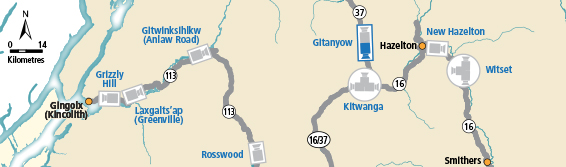
Gitanyow - S
Hwy 37N at Kitwancool Access Rd about 2.5 km south of Gitanyow and 21 km north of Hwy 16 junction, looking south. (elevation: 320 metres) |
||
|
|||
Image Temporarily Unavailable. BC-Yukon Border Hwy 37 at BC-Yukon Border. | Image Temporarily Unavailable. Good Hope Lake Hwy 37 near Good Hope Lake, looking north. |  Dease Lake Junction of Hwy 37 and Commercial Drive in Dease Lake, looking north on Hwy 37. |  Meziadin Junction Hwy 37 and Hwy 37A at Meziadin Junction, looking north. |
 Gitanyow - N Hwy 37N at Kitwancool Access Rd about 2.5 km south of Gitanyow and 21 km north of Hwy 16 junction, looking north. |  Gitanyow - S Hwy 37N at Kitwancool Access Rd about 2.5 km south of Gitanyow and 21 km north of Hwy 16 junction, looking south. |  Onion Lake Hwy 37S at Onion Lake Cross Country ski trails, looking north. |  Kitimat Hwy 37 at Oolichan Avenue, 5 km north of Kitimat, looking North |