BC HighwayCams - Highway 29
Northern, Southern Interior and Vancouver Island images will update every 15 to 30 minutes; Lower Mainland images will update about every two to 15 minutes.
Please note all BC HwyCams use Pacific Time Zone (PT).
Attention motorists:
Spring weather can make highway conditions in B.C. unpredictable, particularly through high mountain passes. Please be prepared and be aware that winter tires and chains may still be needed.
This highway cam image is currently unavailable due to technical difficulties. Our technicians have been alerted and service will resume as soon as possible. |
Hudson's Hope - SW
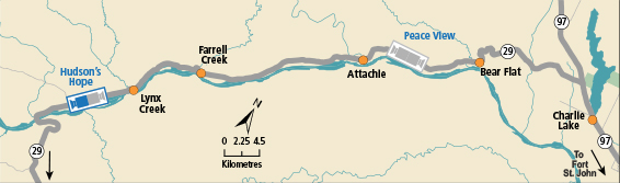
Hwy 29, about 1.5 km north of Hudson's Hope at Powell Rd, looking southwest. (elevation: 527 metres) |
||
|
|
|||
|
|||
Hudson's Hope - NE Hwy 29, about 1.5 km north of Hudson's Hope at Powell Rd, looking northeast. | Hudson's Hope - SW Hwy 29, about 1.5 km north of Hudson's Hope at Powell Rd, looking southwest. | Tumbler Ridge Hwy 29 at Hwy 52, looking westbound on Hwy 29. | Peace View Rest Area - NE Hwy 29, 29 km west of Ft. St. John, looking northeast. |
Peace View Rest Area - SW Hwy 29, 29 km west of Ft. St. John, looking southwest. |
|||